

~~* The Singing Falls Stream Restoration Project *~~
 ϕ
ϕ
~~* A map of the project treatment area *~~
This is a map of the entire area we propose to have treated when the Joe Hall restoration project is completed. The boundary surrounds the entire basin of Joe Hall Creek drainage. As is shown in the legend image Singing Falls Ranch is displayed in white. This will help give you a perspective on the geographic scope of the restoration project. North is at the top. A cross reference image related very closely to this one can be found here

Map legend

TOP

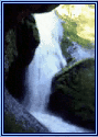
16 meter areal photo of the project area
Stream Index
TOP


