

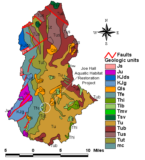
Here is a portrayal of the geological data associated with the Tiller district. Its complexity is evident in this overview. Each zone impacts the flora and fauna in a unique way. Ultimately the composition of these zones migrates into the stream and impacts fish populations. The main influences directly impacting the restoration project are Qls, Tut, Tfe and Tib. An explanation of these terms can be found in the Tiller District Assesment. Click on the link to download the PDF.